
C-MAP Discover & Reveal
Description
C-MAP: A new range of maps that can be used worldwide
C-MAP, a leader in digital marine cartography and cloud-based mapping has launched new simplified and redesigned charts for Lowrance, Simrad and B&G chartplotters with the introduction of C-MAP DISCOVER & REVEAL.
Replacing the MAX-N+ range, C-MAP REVEAL maps showcase the best of C-MAP. This solution offers the unique seafloor and inland shading function, as well as all the main functions of C-MAP DISCOVER, including full vector maps.
“This is a really important evolution for C-MAP,” explains Max Cecchini, EVP C-MAP. “We heard our customers say that the C-MAP range was too complicated, and we adapted, offering a simple, two-tier product range that provides extremely reliable data to all products, including the basic DISCOVER series.””With REVEAL, boaters have additional features available, including the function for shaded relief views anywhere for coastline and hinterland, previously only available in our local products in very restricted coastal areas. It was our customers who asked for this ‘revolution,’ and we are excited to change the game for all boaters by making this view available globally.”
C-MAP Reveal: the revolution
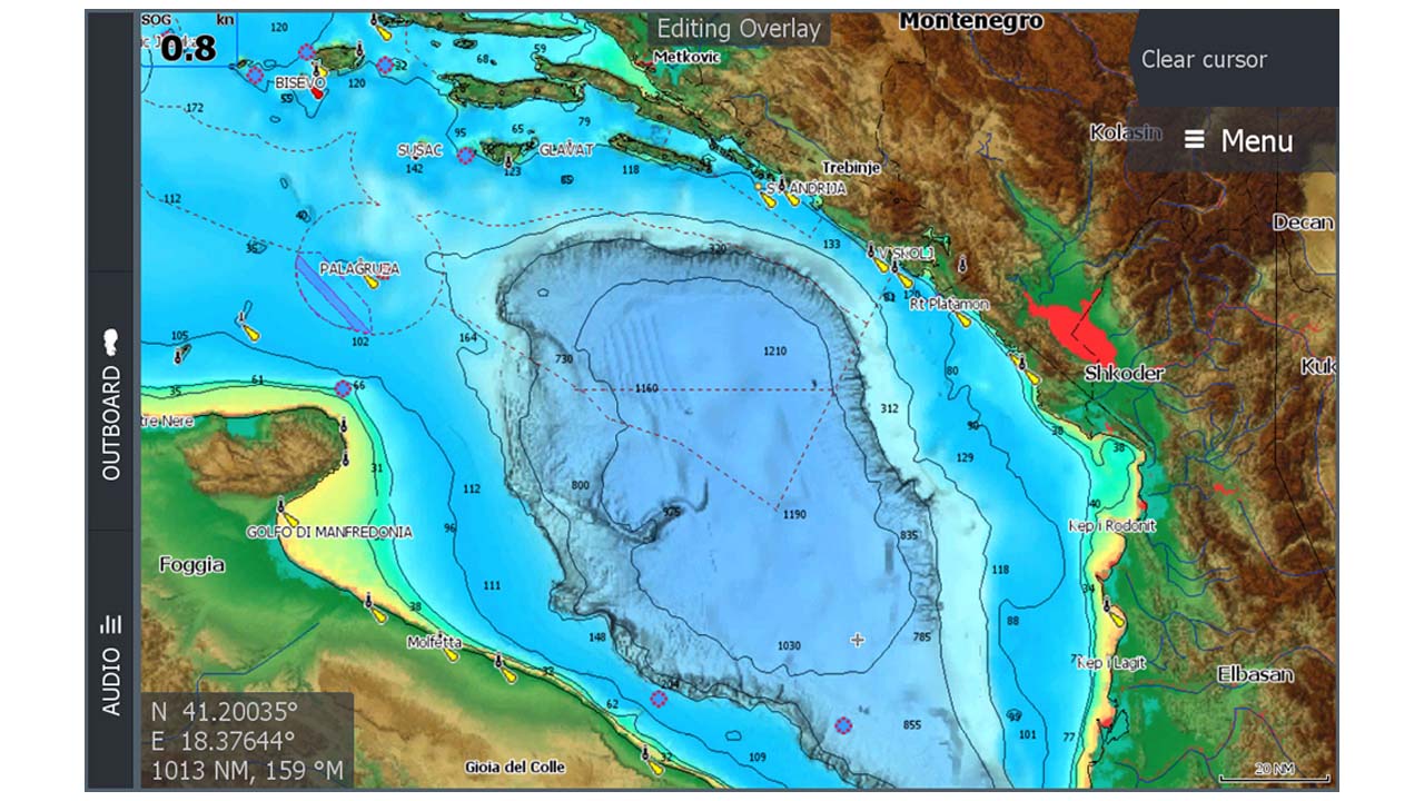
See the world around you like never before with REVEAL relief shading now available worldwide. 3D representation of land surface and underwater surveys with ultra-high resolution bathymetry images, previously available only in MAX-N+ Reveal, represents a revolutionary breakthrough for fishermen and divers.
C-MAP Reveal also offers dynamic raster maps, which look similar to traditional maps, with easy access to all objects on the map, and aerial photography, which provides an additional level of detail with thousands of photos of marinas, harbors, inlets, and other relevant navigational features.
REVEAL’s satellite overlay provides real reference and improves situational awareness during coastal navigation if you are in an unfamiliar environment.

Main functions
- Shaded relief
- Full vector maps
- High-resolution bathymetry
- Custom depth shading
- Dynamic raster maps
- Easy Routing™
- Aerial photography
- Satellite overlay
- Tides and currents
- Detailed plans of ports and marinas
- Details on ports and entrances
- Online updates, including free online updates for 12 months
- Compatible with Lowrance®, Simrad® and B&G® chartplotters
C-MAP Discover: make the most of your time on the water
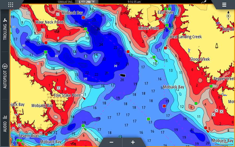
For boating, fishing or sailing, C-MAP DISCOVER offers a wide range of covers and all the essential functions to enable you to make the most of your time on the water. DISCOVER offers Complete Vector Maps and the best of high-resolution C-MAP bathymetry, including integrated Genesis® social map data.
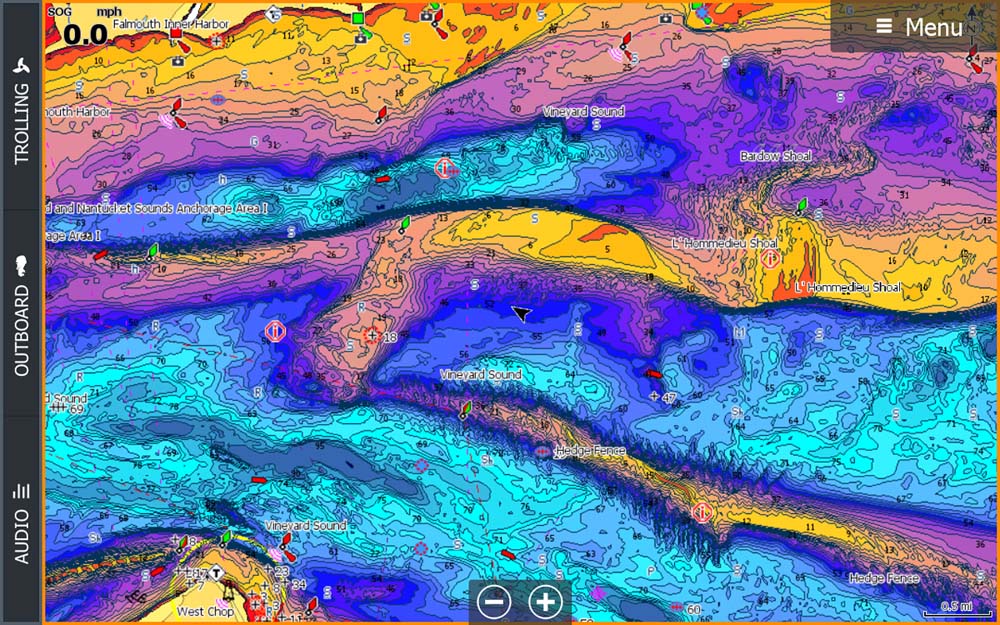
DISCOVER cards includecustom depth shading. Shaded contours show the highest level of information on rocks, walls, and underwater canyons. You can set a precise safety depth or create custom shading-a popular and ever-present feature for fishing.
The Tides and Currents feature shows projections of water level and tidal direction to help you plan your day of boating, fishing, or sailing. Easy Routing™ free subscription helps you automatically plot the shortest and safest route, based on detailed chart data and personalized information about your vessel.
Other functions
- Full vector maps
- High-resolution bathymetry
- Custom depth shading
- Easy Routing™
- Tides and currents
- Detailed plans of ports and marinas
- Details on ports and entrances
- Online updates, including free online updates for 12 months
- Compatible with Lowrance, Simrad® and B&G chartplotters
Learn more about C-MAP Discover & Reveal:
REQUEST INFORMATION


